Hiking & Trekking
Ecuador’s most iconic trails
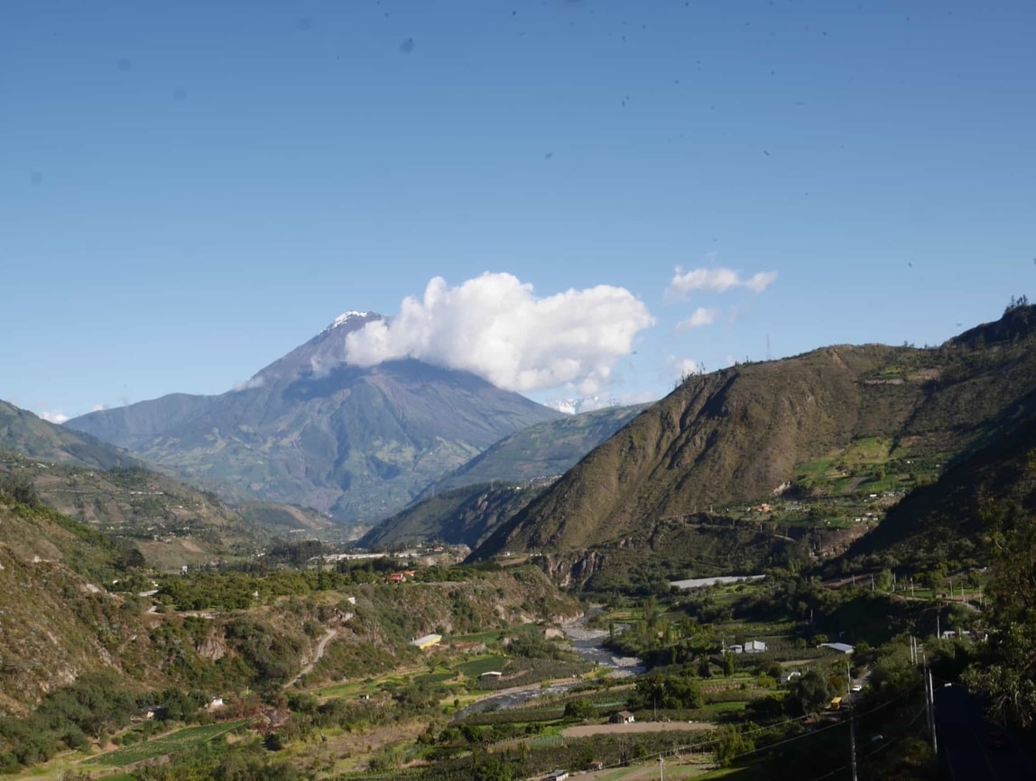
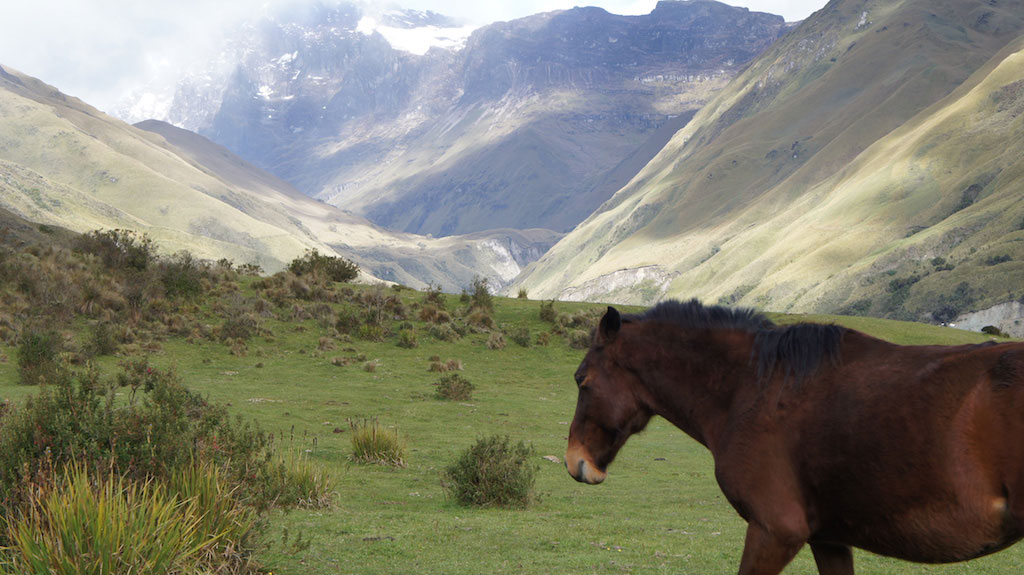
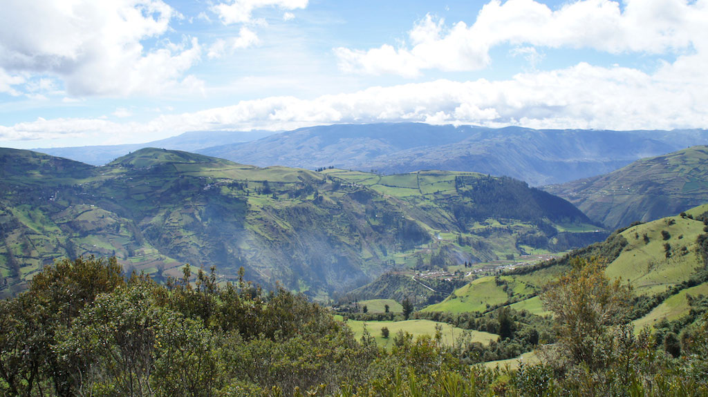
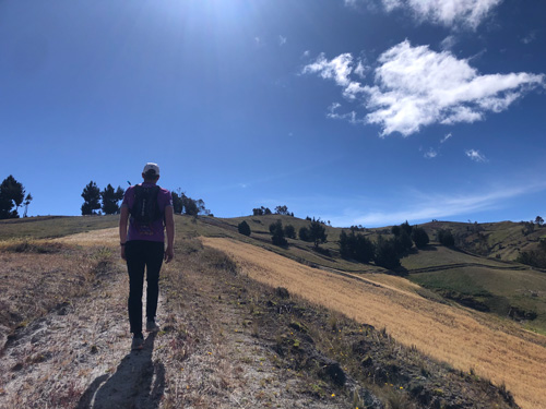
Ecuador is a paradise for hiking and trekking, and we are experts in this field! With a territory about half the size of France, 1.2 times larger than the United Kingdom, and roughly the size of the U.S. state of Colorado, covering 269,000 km² (104,000 mi²), Ecuador has protected 20% of its land under various categories, including National Parks, Wildlife Reserves, Ecological Reserves, and more. This protection ensures an incredible diversity of landscapes, varying altitudes, and well-preserved natural beauty.
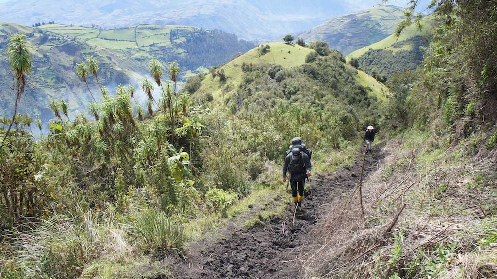
From the Amazon Rainforest to the Andes Mountain Range, you’ll find trails that cater to all levels of hikers. Whether you’re looking for easy and accessible day hikes or challenging multi-day trekking expeditions, Ecuador has something for everyone, from sea level to high-altitude Andean peaks. Here’s why Ecuador is a hiker’s dream destination:
Difficulty:
![]()
![]()
![]()
![]()
![]() > Easy
> Easy
![]()
![]()
![]()
![]()
![]() > Easy – medium
> Easy – medium
![]()
![]()
![]()
![]()
![]() > Medium difficulty
> Medium difficulty
![]()
![]()
![]()
![]()
![]() > Advanced
> Advanced
![]()
![]()
![]()
![]()
![]() > Expert
> Expert
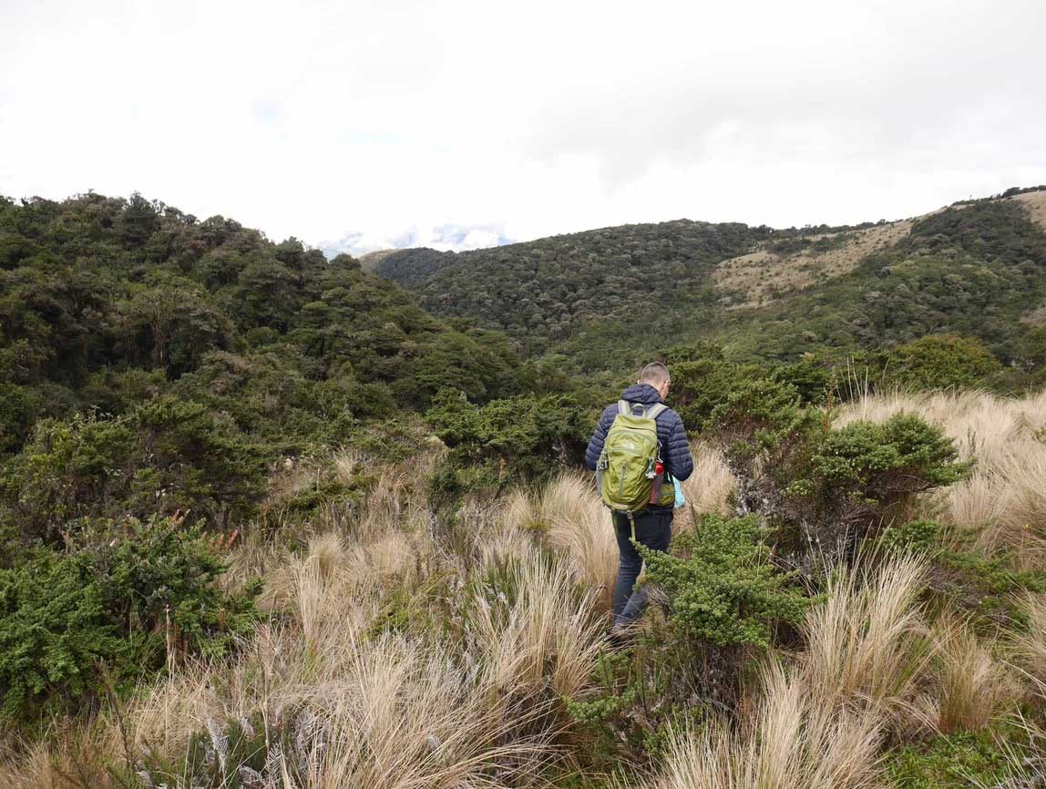
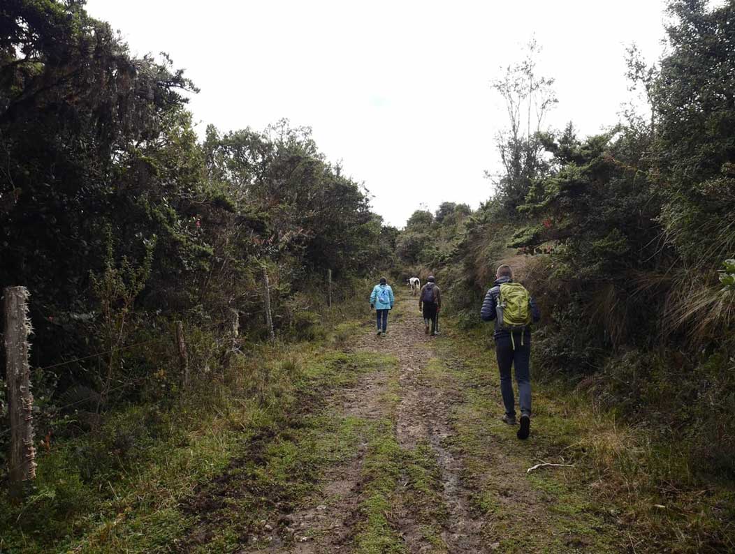
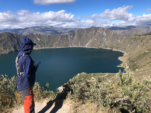
The Quilotoa Loop Trek

Through rural valleys, the Chugchilán trek will take you through the western Andes.
Duration: 3/4 Days
Hike time -per day-: 5-6 hours
Difficulty: ![]()
![]()
![]()
![]()
![]()
Route:
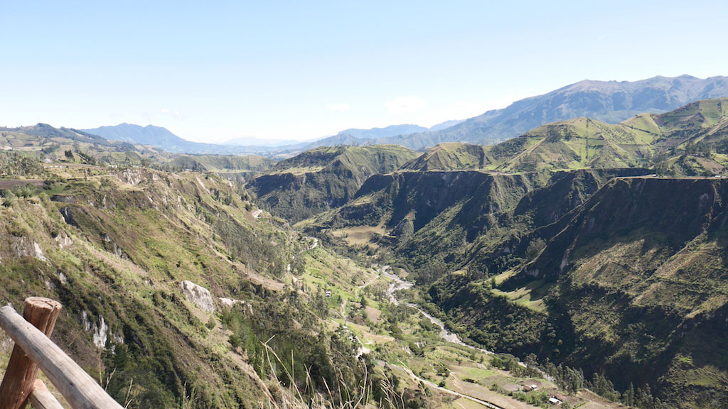
Loop and not loop at the same time, you will start in the Quilotoa region, then you might want to finish at the Quilotoa Lake or continue a last but not least trek stage, the Quilotoa-Tigua. This latter might be the longer and for some, the harder. This is a very flexible trek as you can even start from the Quilotoa Lake itself (depending on your program and hiking level), however, we have do it in a gradual elevation ascent.
Day 1 – Starting from Sigchos, you will have a nice hike to the Isinliví village. The distance is about 10km (6,22 mi) and elevation will be positive E+ :547m (1794 ft). Hike time will be about 4h and Sigchos is located at an altitude of 2.383 m (7.818 ft).
Day 2 – The second day will also be in positive elevation E+ :734m (2.408 ft). You will reach the Chugchilán village. The highlight of the day will be the Toachi Canyon. You will reach Chugchilán after a hike of about 5h along a 12,4km (7,71 mi) trail. Isinliví is located at an altitude of 2930m (9.613 ft).
Day 3 – The third day will be the most challenging. With a positive elevation of E+ :1049m (3441 ft). Your reward will be reaching the beautiful Quilotoa Lake 3.914m (12.841 ft), the highlight of the day. You will reach the Quilotoa after a hike of about 6h along a 13,4km (8,33 mi) trail.
Day 4 – Depending on your physical condition, program, and available time you can continue this adventure and finish with the lovely Quilotoa-Tigua trek trail. One of our favorites, this will be a challenging day trek with negative elevation. Contact us for more details.
Route highlights : The Toachi Canyon, the Quilotoa Lake, and Isinlivi Village.
Elevation: Max. altitude 3.914 m (12.841 ft) at the Quilotoa Lake.
Accommodation: Hotels & Inns.
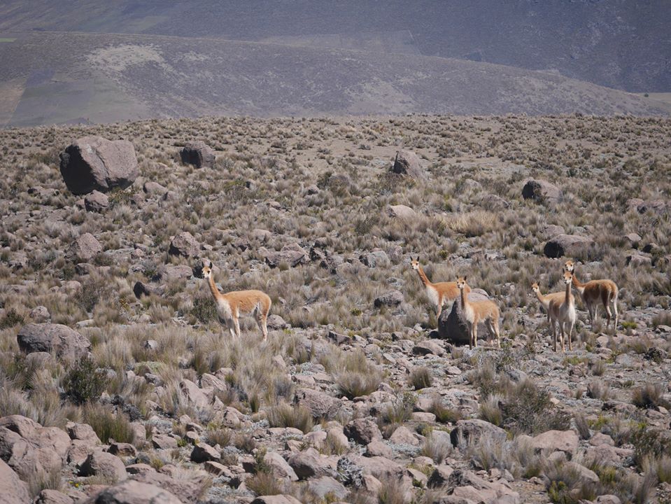
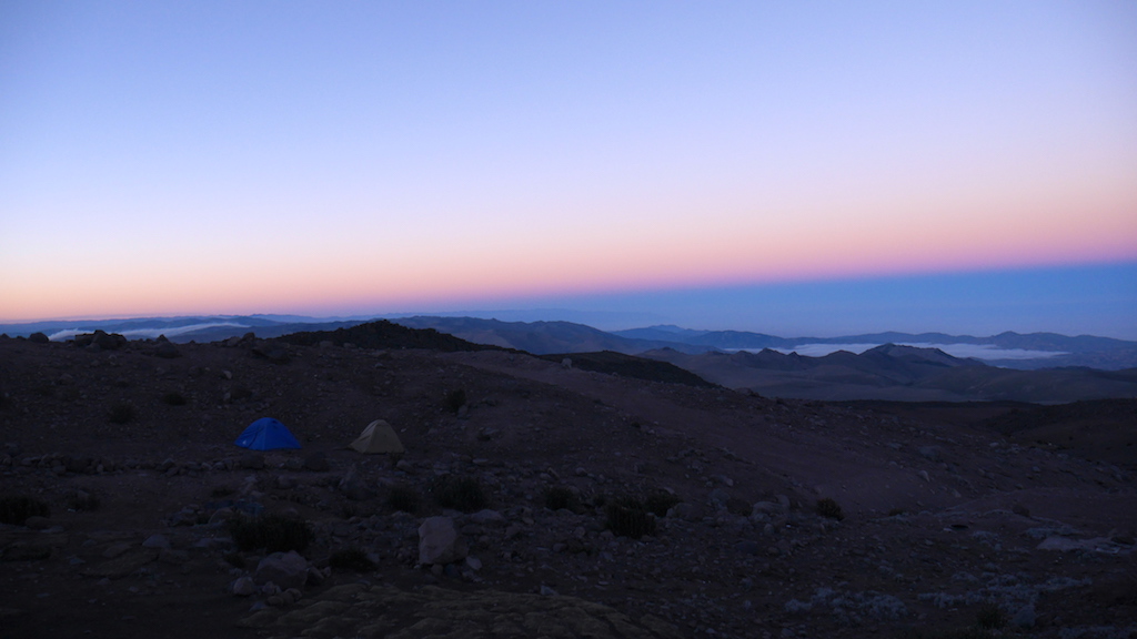
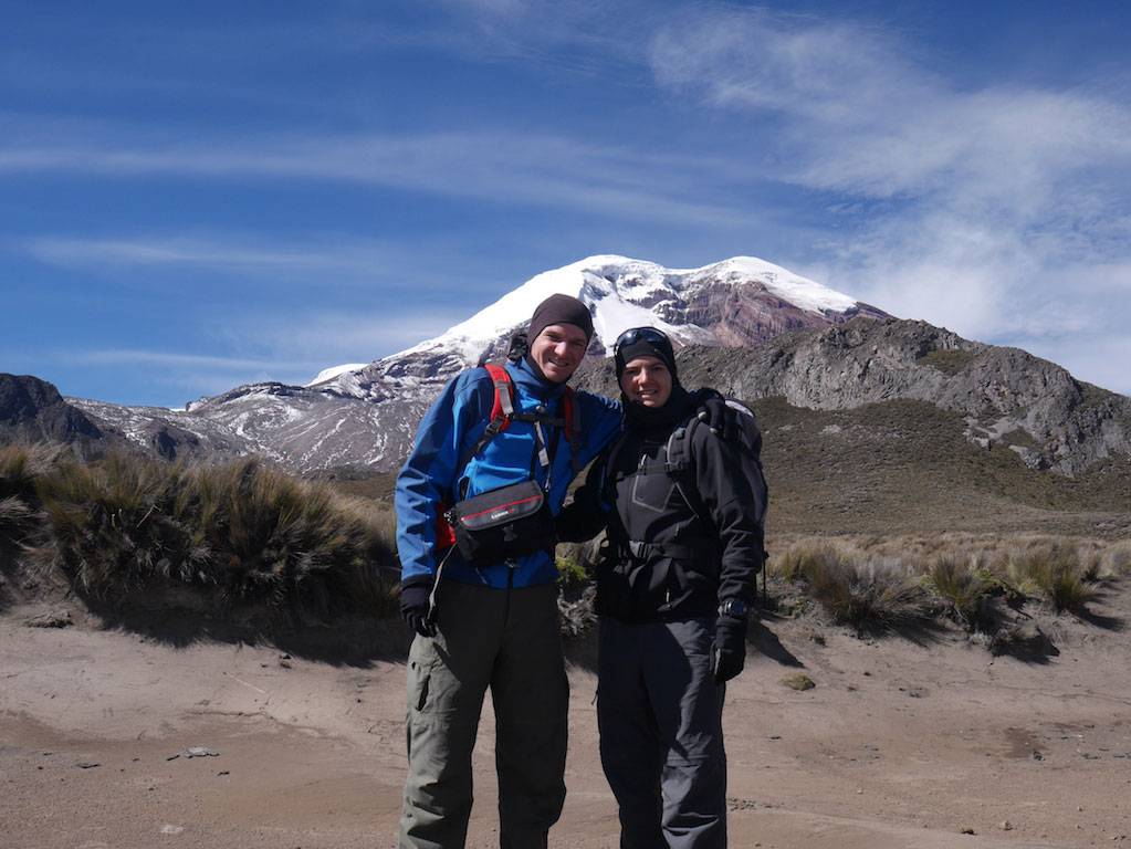
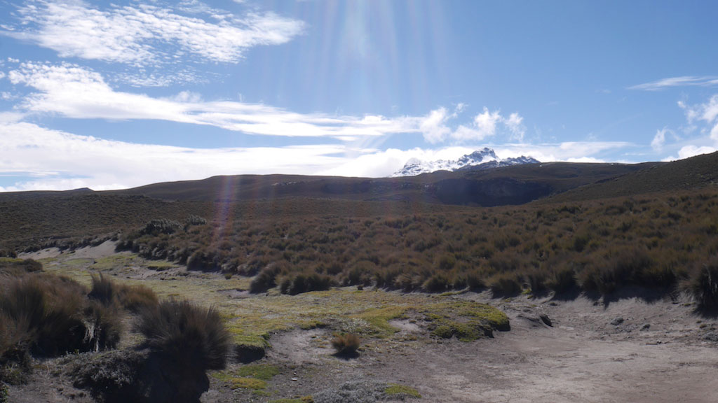
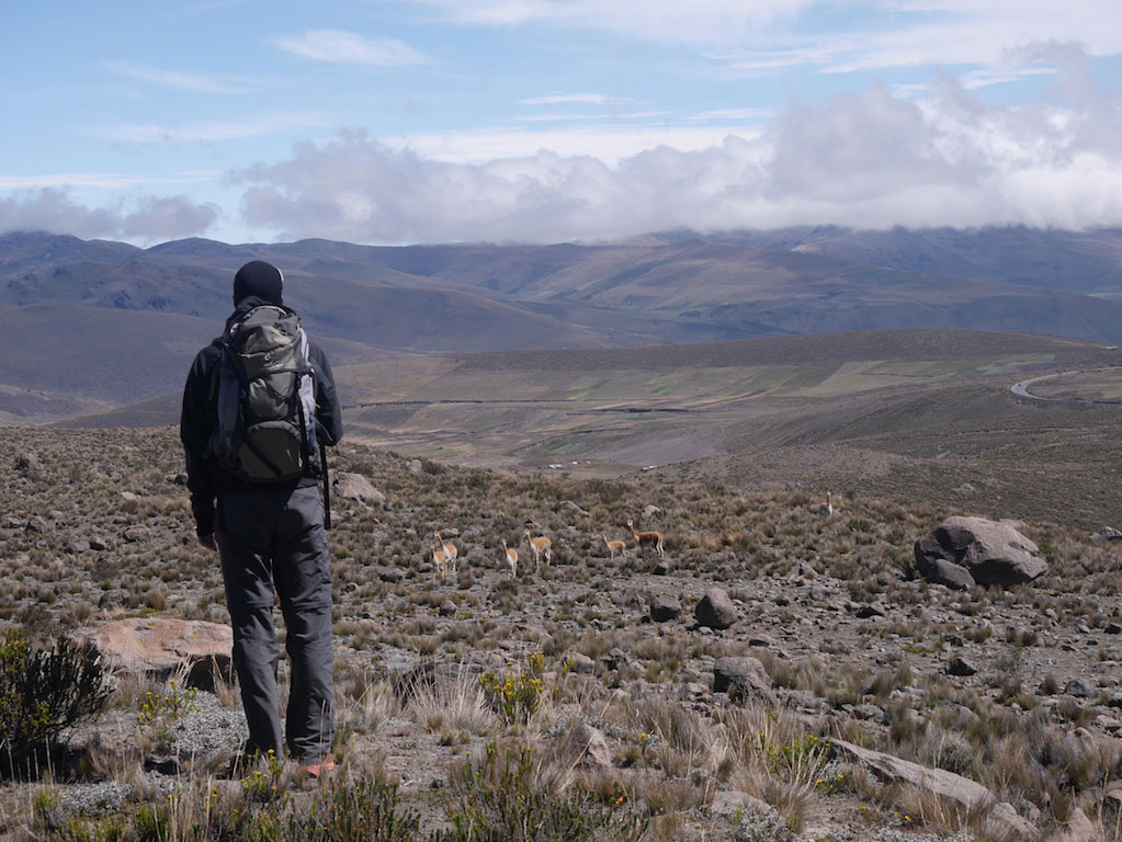
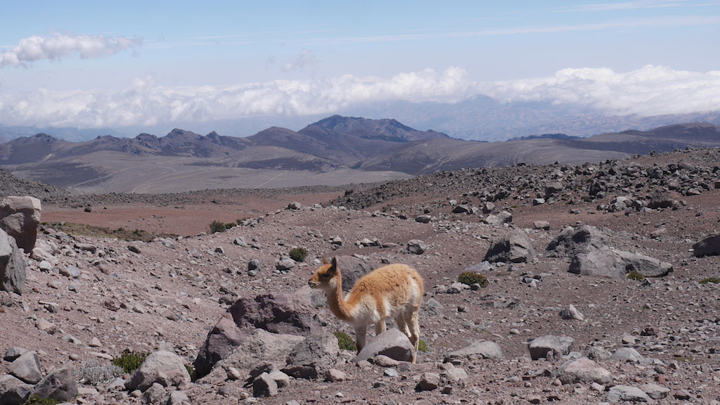
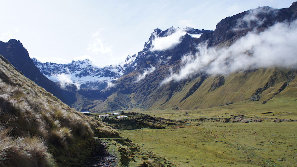
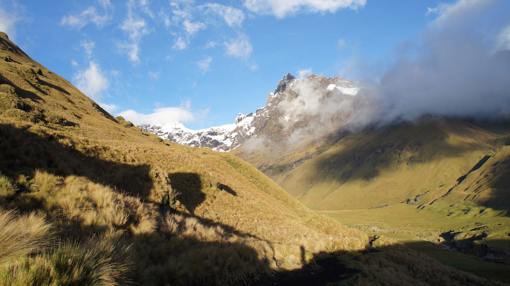
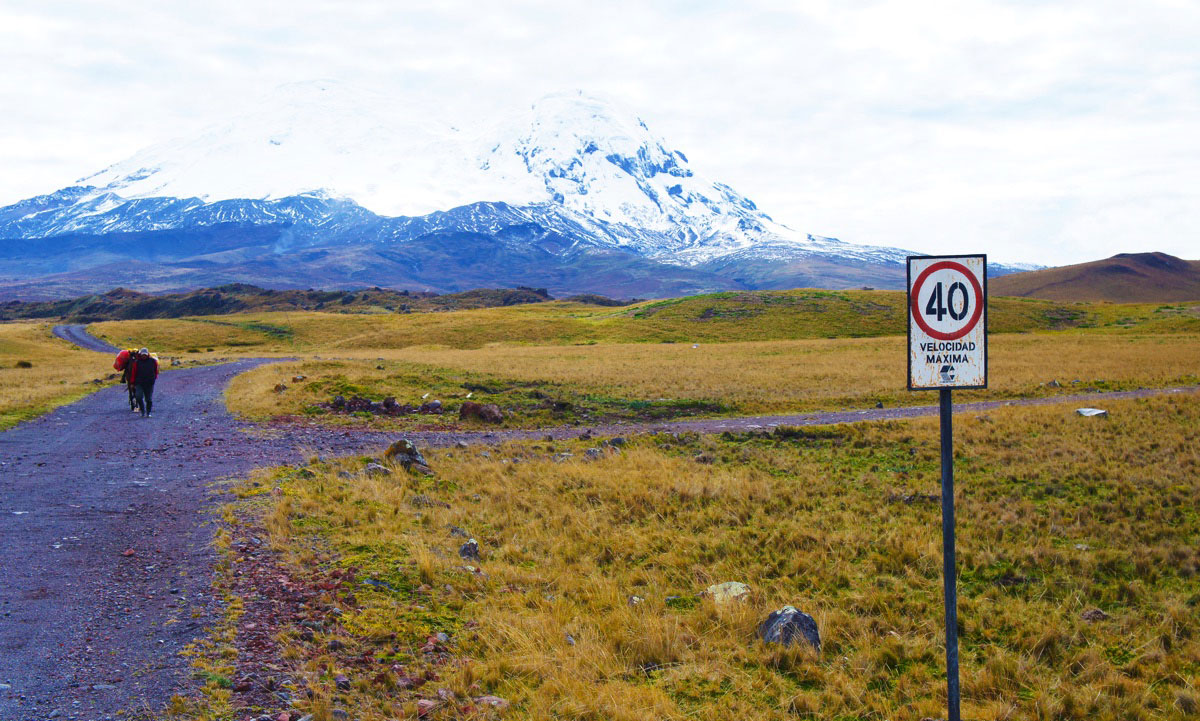
The Vicuñas Trek.
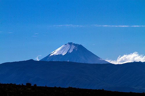
The vicuñas trek is a loop around the highest peak in Ecuador, the Chimborazo.
Duration: 3 or 4 Days
Hike time -per day-: 6 to 9 hours
Difficulty: ![]()
![]()
![]()
![]()
![]()
Route:
Day 1 – 13 km (8,08 mi), you will start on the Chimborazo slopes, between the Mechahuasca Refuge and The Carihuairazo.
Day 2 – 15 km (9,32 mi), you will walk to the Chimborazo’s other side, this day will be hard, but the climate will normally be dry. The vicuñas will accompany you. Arrival at the Carrel brothers’ refuge.
Day 3 – 10 km (6,22 mi), easiest day since you will descend to Casa Condor community.
Route highlights : Constant view of the Chimborazo volcano (if the weather is not overcast), you will also see the Carihuairazo, the Altar and, if the weather is very clear, the Sangay. Vicunas and hummingbirds will accompany you. You will be in a wet landscape then the dry paramo.
Elevation: Max. altitude – 4.864 m (15.961 ft) during the second night at “Hermanos Carrel” refuge. Elevation gain – E+ 1599 m (5249,3 ft).
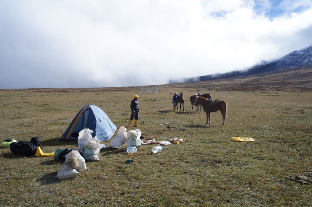
Accommodation: Two possibilities are available, the first is to sleep in a refuge, the second is to sleep in a tent.

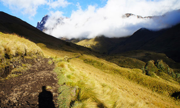
The Condor Trek
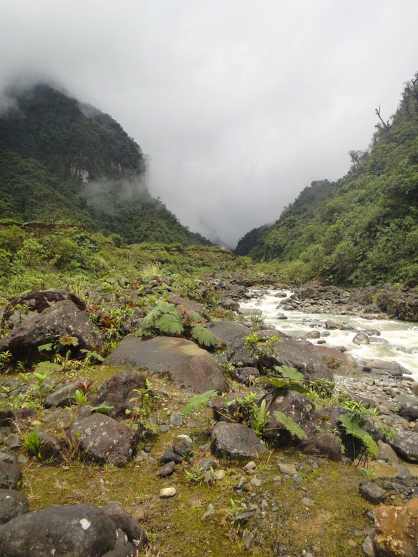
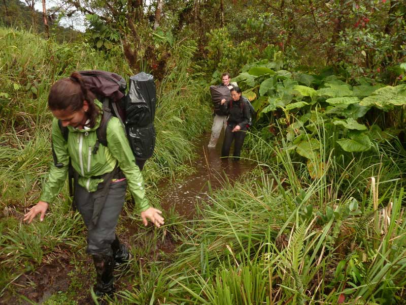
The Condor Trek, in the Antisana Reserve, is one of the most beautiful and spectacular treks in Ecuador. It is however difficult and requires very good condition. The first two days of treks are almost always very muddy and wet and it is recommended to do this trek in boots although it is more strenuous.
Duration: De 3 to 5 Days depending on the level.
Hike time -per day-: 7/10 hours
Difficulty: ![]()
![]()
![]()
![]()
![]()
Route:
Day 1 – from El Tambo to the volcano lake.
Day 2 – You will cross the paramo then camp in the highlands at the Antisana Volcano foot.
Day 3 – You will stay this night near a lagoon near in front of the Sincholagua volcano.
Day 4 – You will climb the Sincholagua volcano slopes before descending to Cotopaxi National Park.
Route highlights : Views and passages at the Antisana Volcano foot, Sincholagua, and Cotopaxi volcanoes. You will pass by many lagoons such as Santa Lucia and Micacocha. You will have the opportunity to see the great Andean condor while crossing the Antisana reserve.
Elevation: Max. altitude – 4199 m – 4780 m (13.779,5 ft – 15.748,03 ft) if you decide to go up to the Cotopaxi refuge, on the last day.
Accommodation: During the trek you will sleep in tents. The last night, you can stay in a charming hacienda in the Cotopaxi National Park.
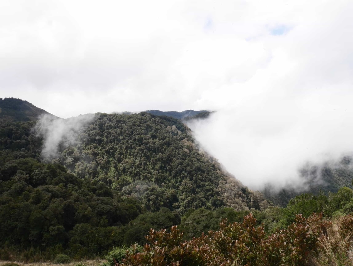
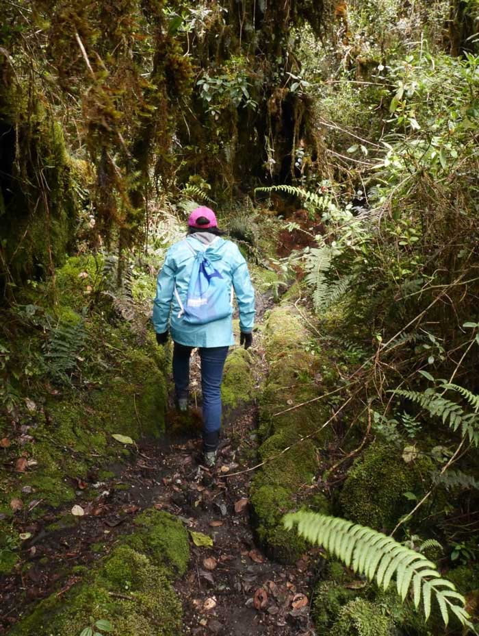
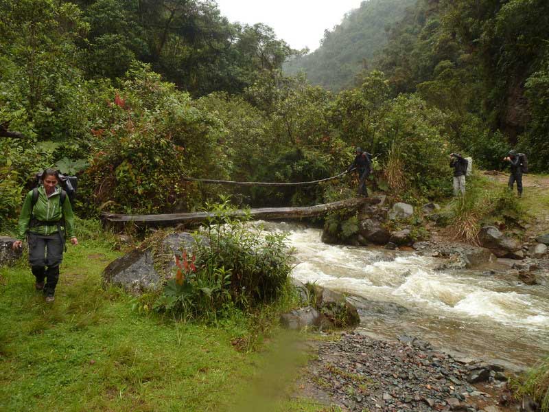
Lloa-Mindo Trek
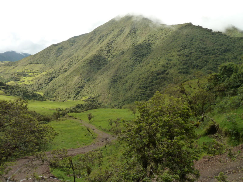
Starting from Lloa, The Mindo trek, is the path going from the Andes at high altitudes (3000m), towards a village located in the tropical Mindo forest (1200m). This very pleasant and original trek (treks in tropical forest are rare) remains really accessible. Although quite muddy due to the soil nature and the region climate, boots are not necessary Our full report here.
Duration: 2 Days
Hike time -per day-: 5-6 hours
Difficulty: 3/5
Route:
Day 1 – Departure from Lloa, 9.842,5 ft at the Guagua Pichincha foot. The climate is often humid, but hotter than the Andean heights.
Day 2 – You will continue through the tropical forest to the Mindo region.
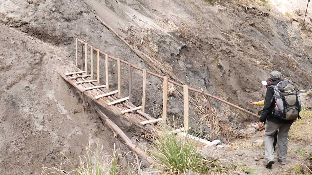
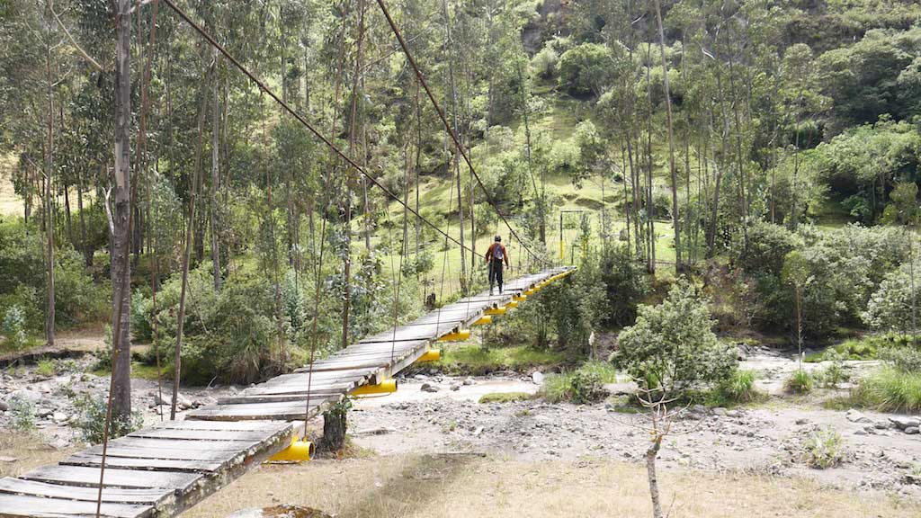
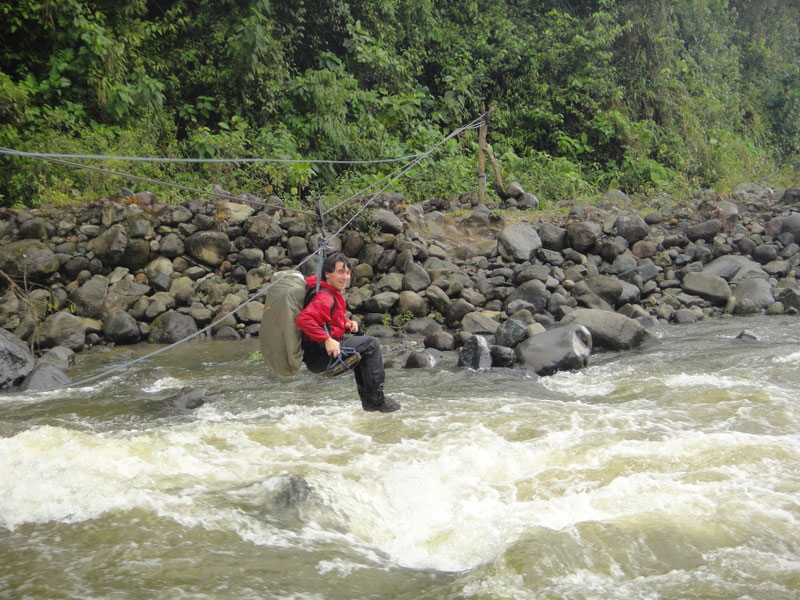
Route highlights: Crossing the “cloud forest” with magnificent tropical forest landscapes. You will have to cross a river several times, including once on a makeshift zipline.
Elevation: Max. altitude – 9.842,5 ft. The elevation gain is low since it is a “downhill” trek to Mindo located at 3.937 ft..
Accommodation: The night of the trek takes place in a tent, and the other night will be provided in Mindo on your arrival.

The Altar Trek
The Altar trek will take you to “The Volcano 9 peaks” crater’s heart. Located in Sangay National Park, Altar is one of Ecuador’s most lavish volcanoes.
Duration: 2-3 Days
Hike time -per day-: 5-8 hours
Difficulty: 3/5
Route:
The start is in La Candelaria village, and continues on to the heart of the Sangay Volcano crater.
Route highlights : A view in this sublime volcano’s heart. A circus with many lagoons within it.
Elevation: Max. altitude – 14.107,6 ft. Elevation – 1 656,16 ft
Accommodation: You will camp in a tent and on the way.
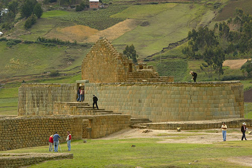
Ingapirca trek
Along the Ingapirca trek you will take the route that the Incas used to connect their communities.
Duration: 2 Days
Hike time -per day-: 8 hours
Difficulty: 3/5
Route:
You will start in the Achupallas village and then arrive at Ingapirca. You have the option of doing this trek in the opposite direction.
Route highlights : You will walk on the historical and most impressive Ecuador’ Inca site, Ingapirca, the best-preserved Inca site in Ecuador.
Elevation: Max. altitude – 13.779,5 ft
Accommodation: You will camp in a tent on the way.
Sangay Trek
The hardest in Ecuador! The Sangay is hight-level trek and probably one of the hardest you will encounter in your trekking life.
Duration: 6-7 Days
Hike time -per day-: 8-9 hours
Difficulty: Extreme (high level resistance required) – The most difficult trek in Ecuador.
Route:
On average this trek lasts 3 days, there is no marked path, you will have to make your way through dense and wet vegetation.
Day 4 : you will climb the active Sangay volcano, approximately 7 hours of ascent.
The return is by the same route, over 2-3 days.
Route highlights : The Sangay volcano ascent will be the climax of this trek. A great sporting challenge.
Elevation: Max. altitude – 17.158,7 ft
Accommodation: You will camp in a tent on the way.
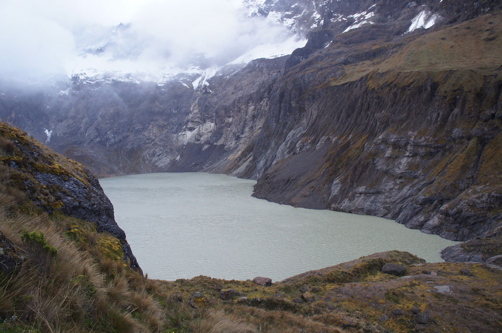
Cuicocha Hike
The Cuicocha Lagoon, located in the Otavalo region, is one of the Cuicocha volcano craters. An easy and picturesque walk overlooking this lagoon is very accessible.
Duration: 4 hours
Difficulty: 2/5
Route: A 45-minute walk to reach the lagoon will be necessary. Then you will do the tour while overlooking this magnificent lagoon.
Route highlights : The constant lake view with its two beautiful central islets.
Elevation: Altitude – 10.498,6 ft.

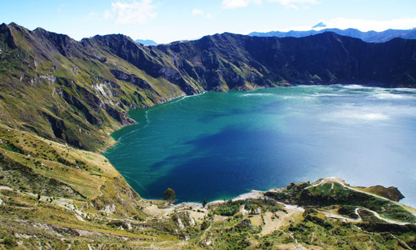
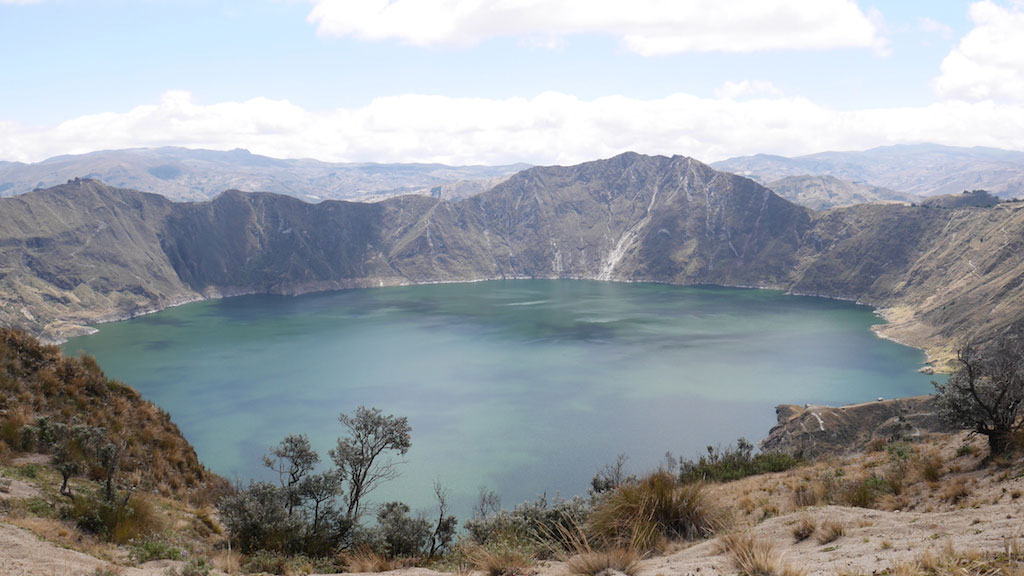
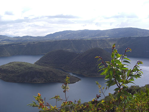
Quilotoa Hike
The Quilotoa Lagoon is a superb lagoon with magnificent blues and greens water reflections. This unique lagoon is located in the Cotopaxi region, near Latacunga.
Duration: 5 hours
Difficulty: 2/5
Route: A walk around this crater is easily accessible.
Route highlights : The lagoon view with its changing colours depending on the light and location.
Elevation: Altitude – 12.795,2 ft.
Tigua > Quilotoa Hike
This challenging trek, will let you discover the isolated valley of Tigua and the beautiful landscapes behind the volcano whose summit is a water-filled caldera called “the Quilotoa Lake”. Accept this challenge!
Duration: 5 hours
Difficulty: 2,5/5
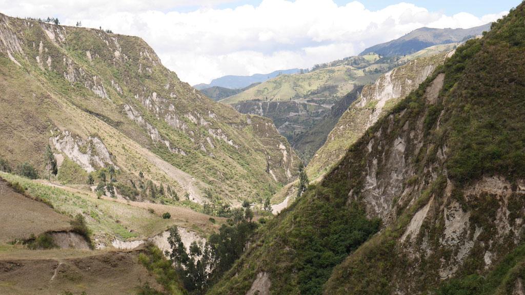
Route: You can do it in both directions. Either from Tigua or Quilotoa. Either way you will descend and ascent a picturesque canyon, this will remain the most difficult part of the trail.
Route highlights : The canyon & the arrival to Quilotoa lake.
Elevation: Altitude 2132ft.
Cubilche Hike
This “trek”, which is more “a day hike”, will take you from the San Clemente community to the San Pablo Lagoon along the Cubilche volcano slopes.
Duration: 5 hours
Difficulty: 2,5/5
Route: You can do it in both directions. Either in the lagoon-free San Pablo direction to San Clemente or vice versa. You will walk along the Cubilche volcano slopes.
Route highlights : The view of the San Pablo lake.
Elevation: Altitude – 13.779,53 ft.
The Boliche Trek
This one-day trek takes place in Cotopaxi Park near the Rumiñahui volcano.
Duration: 7 hours
Difficulty: 2/5
Route: You will leave from the Limpiopungo lagoon before joining the Rumiñahui volcano where you will pass near the summit. You will then arrive in the protected Boliche reserve where you will see atypical flora and fauna.
Route highlights : During the route on the Rumiñahui Volcano side you will have the opportunity to see hummingbirds. The Cubilche forest is also atypical and unique.
Elevation: Altitude – 13.123,3 ft
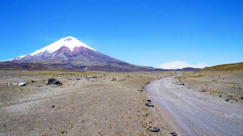
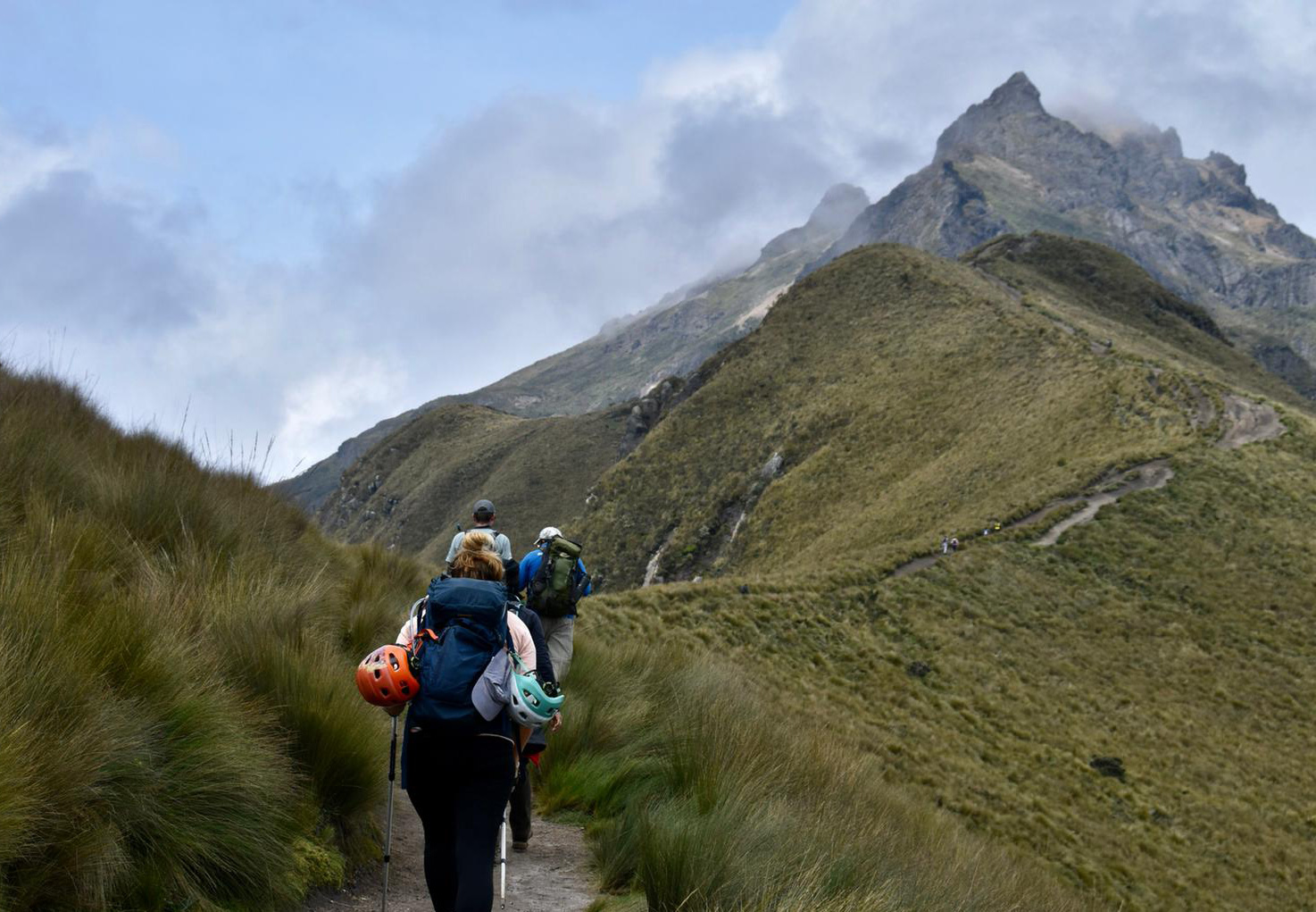
Cotopaxi Park Hike
Cotopaxi National Park is one of the most beautiful protected nature reserves in Ecuador. Many treks and hikes are easily accessible.
- Around the Limpiopungo Lagoon: Difficulty – 1/5 … Duration – 40 min
- Ascent to the Jose Rivas refuge : Difficulty – 2/5 … Duration – 45 min
- Salitre Trek: Difficulty – 2/5 … Duration – 7h (20km)

Leito Hacienda Hikes (Baños & Riobamba region)
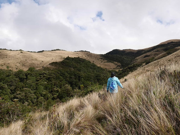
From the Leito Hacienda, near Patate (Tungurahua, Baños region), you can discover, through accessible walks -of varying duration-, this region biodiversity between the tropical forest and the Paramo. You will be able to cross both climates and vegetation during the same walk, which is very rare in Ecuador. Nearby Andes Breath-taking views await you.
- Bear watching walk: Difficulty – 1/5 … Duration – 2 hours (possibility of spotting Andean Bears depending on the time of year and your luck!))
- Walk between tropical forest: Difficulty – 2/5 … Duration – 5 hours